Ilha Brava
Tags: Cape Verde, Ilha Brava, Nova Sintra, sailing
Date: November 23, 2016
Ilha Brava was the last island we visited in Cape Verde. Here is a map of our route through the country:

We anchored in a bay on the west side of the island. The trip from Santiago was done as an overnight sail. It was too long to do during the daylight hours of one day, so sailing overnight allowed us to arrive in the morning with daylight.
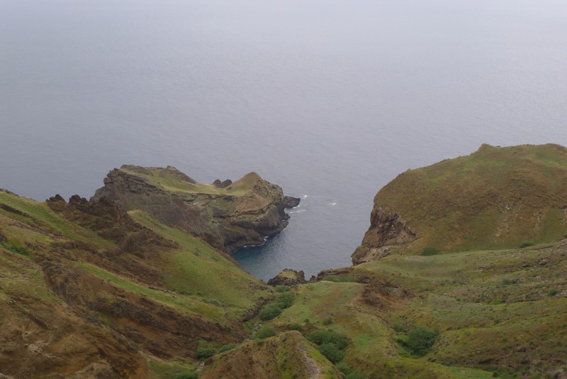
Approaching Brava:

We spent the first day here resting and doing some chores on the boat. After dark, I went for a dive. There were lots of fish and there was a vertical wall from the surface to over 30 meters in some places. So it was a great place to dive. I also saw the first shark of our trip. It was a harmless nurse shark. We have seen them in other parts of the world in the daytime, where they are mostly resting. But at night they are active, searching for food.
It is greener here than the other Cape Verde islands we visited. We went for a long walk up through the river valley to the town of Nova Sintra.
The valley had lots of vegetation, some of it crops. Here you can see sugarcane (the flowering plants):

The view down the valley towards the bay where we anchored:

There was a tiny village in the valley and several other houses spread out:

Big spiders in webs suspended over the path between trees of each side of the path. Mostly the webs are positioned high enough for us to go under but once in a while we would have to duck under the webs:

Another cultivated area at the top of the valley:

Finally, we made it all the way up the valley to the road on the plateau on top of the island:


This is the outskirts of Nova Sintra:

Donkey carrying water:

Isn't it cute?

The central square of Nova Sintra:

We really enjoyed Brava. There were no tourists, so everybody were friendly and nobody was trying to sell us anything. The downside was that we didn't find a restaurant, so had to eat granola bars and crackers for lunch.
On the way back to our bay, we followed the road around the mountains instead of the path through the valley.
This part of the island had no inhabitants:
It must have been a lot of work to build this road. As most other paved roads in Cape Verde, it is paved with cobblestones. Some places had a lot of material removed to accommodate the road:

In this part of the island, the rocks appear to be sandstone. It is probably volcanic ash that was compressed over time:

Here is a view of the airport:

You may wonder why there are no tourists when there is an airport? Well, the airport didn't work out too well: It was opened in 1992 and closed in 2004 due to continual problems with strong winds. Maybe someone should have asked the local fishermen what the winds were like in that region before they built the airport. The little experience we have from mountainous islands like the Canary islands and here is that the winds can change suddenly and dramatically close to shore: sometimes it is calm and sometimes it is very windy. So we are always careful when sailing behind tall islands.
Our bay is the one right behind this outcrop:

Here we are:

Almost back to the bay, here is the church:

Notice the road that we came down behind the church. Again, it must have been hard work building it.